Six Reasons You Need a Map on the Trail
by Robert Eversole
 There are many tools that are commonly used to help find your way happily down the trail. While the single most important element in your equine travel toolbox is you, a map of where you’re riding is a close second. Let’s take a moment to consider the often overlooked map.
The first use of the word map, as we know it, was in the early 16th century. From the Latin “mappa” (napkin or sheet) and mundi (of the world) we have mappa mundi or “sheet of the world.” What a glorious definition of a humble piece of paper representing the world.
A map can and should be the basis for planning every trip. The information that a map contains can help you choose the perfect campsite, find water sources, determine the difficulty of your route and even help you estimate how long you’ll be on the trail. A map provides such a good picture of an area’s terrain that it’s hard to understand why riders would ever depart the trailhead without one. Unfortunately riders often do so, especially when they think they’ll stay on the trail.
To put it in a different perspective a map is a teleportation device. With a map you can visit an area without ever pulling into the trailhead or talk about it with someone who has: The trail begins at the end of a gravel road on the south side of a camping area located in the middle of a broad flat valley with a stream running along the edge. For the first ½ mile we’ll ride along with the stream on our right. Riding this section during the afternoon will provide the best lighting for photos of the towering cliffs that line the left side of the valley. In a mile and a half we’ll leave the streamside—better top off our water here if the ponies are thirsty—and head uphill. Soon, we’ll drop into a slot canyon as we work our way down hill towards a gem in the desert, a waterfall.
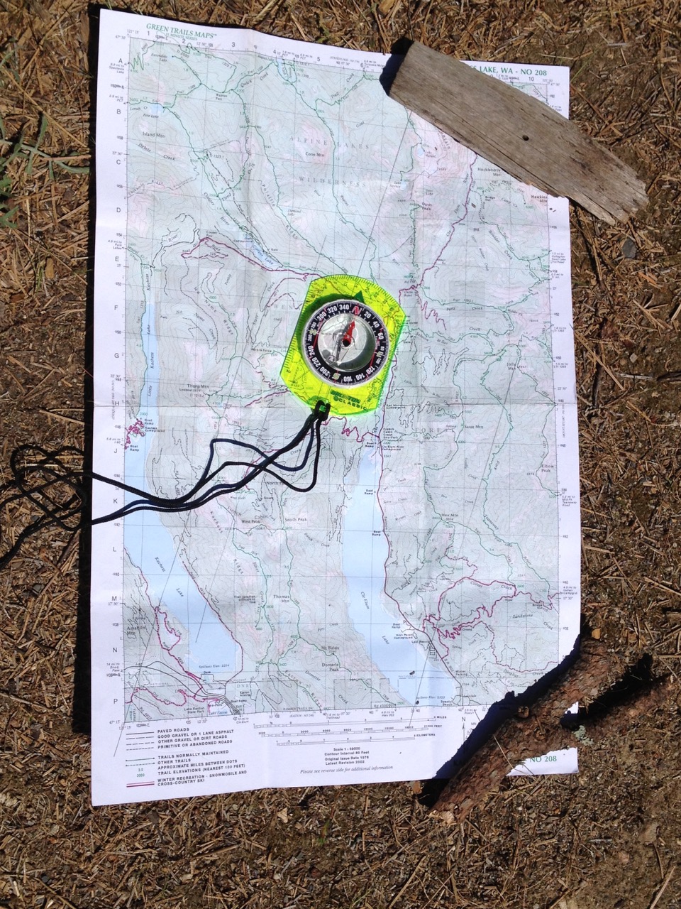
The source of all of these details is of course that “sheet of the world” or, as we would call it in the 21st century, a map. A map gives us a bird’s eye view of the area on a flat piece of paper filled with symbols to help guide the way. Different types of maps give us different types of information so you might need more than one for any given trip. Two of the most common types of maps that you’ll encounter are planimetric and topographic. Planimetric maps treat the ground as flat and you most likely have one in your truck. Most commonly found as highway maps, this type of map generally covers a large area and accurately places roads and towns making it perfect for the job of getting you to and from the trailhead.
A rider’s best friend is the topographic map. Through the use of contour lines it will give you a detailed picture of the shape of the land you’ll be exploring on horseback: the hills, depressions, flat areas, cliffs and other features you’ll need to know about. The various colors and symbols on the map will help you find water, campsites, and many other valuable bits of information that will help you on your ride. Besides helping you find your way, a topographic map can just be fun to use. If you need more reasons to bring a map along on your next ride here are six more:
- A few minutes spent inspecting your topographic map before your ride can give you a tremendous amount of information about your upcoming trip.
- The map will preview your trip by showing you not only where the trail goes, but also some of the treasures and obstacles you’ll find along the way. These may include areas with wonderful ridge-top views, challenging water crossings and more
- The elevation data will show you where you might encounter lingering spring snow in early summer, or where a fall ride might include a dusting of the white stuff.
- The patterns of the contour lines will tell you how steep a trail segment will be and how hard your ponies will be working to make the climb.
- A map will show you likely water sources along your route where you’ll have a chance to quench your horse’s thirst.
- Studying the map will give you a view of the area much larger than what you’ll see from the back of your horse, showing you places to visit you wouldn’t otherwise know about.
As always, for more information on trail riding, as well as the largest equine trail and camp guide in the world, visit www.trailmeister.com.

Robert Eversole, ”the trail meister,” owns www.TrailMeister.com, the largest database of horse riding and camping areas in the U.S. with free trail and trailhead information, trail maps, and much more to help horse enthusiasts experience the joys of trail riding. Robert is a registered riding instructor with PATH International, a mounted search and rescue team member, and a U.S. Marine who has served on the board of the Backcountry Horsemen of Washington (BCHW). He is enjoying his new career helping fellow trail riders stay found and safe on the trail. When not on the trail, The Trail Meister resides near Spokane, WA and teaches land navigation to a wide variety of outdoor groups across the nation. For North America’s largest horse trail and camping directory, trail tips, and more, visit www.TrailMeister.com.